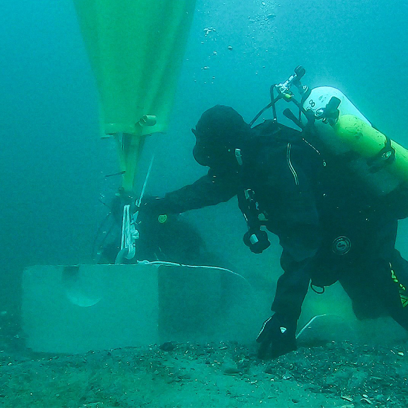
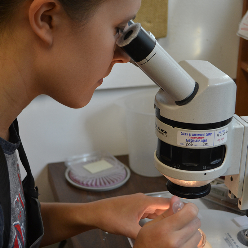
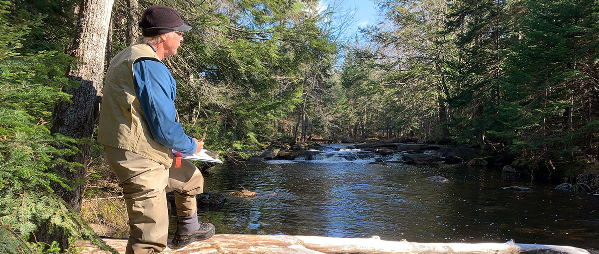
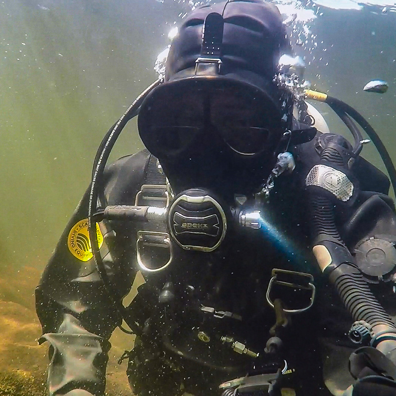
Fish Collection and Characterization
Fisheries Acoustic Studies
Migratory Fish Biology, Behavior, and Restoration
Fish Population Studies and Modeling
Fish Passage Facility Operation Services
CWA 316(b)
Biotelemetry
Population Modeling
Fish Salvage and Relocation Efforts
Fish Scale Age and Growth Analysis
Hydroacoustics
Freshwater Mussel Population Survey and Species Identification
USFWS Qualified Mussel Surveyors
Survey Plan Negotiation and Development
State Approved Mussel Surveyors
Biological Assessments
Salvage, Relocation and Long-Term Monitoring
Scientific Diving Management and Oversight
Navigable Waters Surveys
CWA 316(b) Freshwater Mussel Studies
Section 7 Consultations
Pipeline, Bridge, and Railroad Crossings
Construction Monitoring
Water Withdrawal
Outfall Evaluations
Expert Testimony
Essential Fish Habitat Biological Studies
Benthic Surveys of Organisms and Sediments
Instream Flow Assessments
Aquatic Ecology Assessment
High Resolution Bathymetry
Submerged Aquatic Vegetation Surveys
Stream Redesign (Culvert, Open for Fish Passage)
Habitat Suitability Index Modeling
Habitat Mapping, Modeling and Hydrologic Alteration Studies
Marine Mammal and Sea Turtle Habitat Analysis
Coastal, Estuarine and Marine Ecosystem Surveys
Coastal and Marine Habitat Restoration Planning and Design
Reservoir Fluctuation and Shoreline Assessments
Stream Rapid Bioassessments
Scientific Diving
Hydro Industry-certified Snorkel Teams
CWA 316(a) Thermal Plume Studies
Acoustic Hydrology using Acoustic Doppler Technology
Benthic Surveys
Water Quality Sampling and Monitoring
Hydrokinetic Energy Site Assessments
Groundwater Monitoring
Sediment Sampling and Testing
Stormwater Sampling
Water Quality Assessment and Modeling
Water Supply Planning and Studies (Quantity and Availability)
Vibracore Sampling
Contaminated Sediment Assessments
Dredge Plume Monitoring
Erosion and Sediment Transport Evaluations
Sediment Profile Camera Benthic Surveys
Sediment Sampling, Testing, and Analysis
Dredging and Disposal Analysis and Permitting
SCUBA Certified Divers
Advanced Diver, Rescue Diver, and Certified Dive Masters
US Coast Guard Licensed Boat Captains
Transportation Worker Identification Credential Security Clearance
Conformance with OSHA 29 CFR 1910.401 Subpart T
Entrainment Sample Identification
Fish Stomach Identification and Tissue Sampling and Analysis
Credentialed Taxonomists
Identification and Analysis of Freshwater, Estuarine, and Marine Invertebrates, Algae, and Periphyton
Ichthyoplankton, Zooplankton, and Phytoplankton Identification
Benthic Invertebrates, Algae and Periphyton Identification
Laboratory Processing, Data Capture, and Analysis, Project Reporting
Long Term Environmental Monitoring Database Management
Quality Assurance Program
Benthic Sample Processing
Normandeau’s fisheries biologists are experienced with marine and freshwater fish species. We are experienced with diadromous (anadromous and catadromous) fish populations including both American eel and river herring. Our sturgeon expertise includes anadromous species indigenous to the East Coast, such as the Atlantic and shortnose sturgeon and potadromous species found in the Great Lakes and Mississippi drainages, such as the lake and shovelnose sturgeon.
Normandeau’s expert fisheries biologists conduct Essential Fish Habitat (EFH) and Biological Assessments, sophisticated mark/recapture and hydroacoustic studies, agency negotiation, and mitigation development. We conduct field studies, compile biological assessments and Habitat Conservation Plans, and represent clients in Endangered Species Act (ESA) Section 7 and Section 10 consultations.
Our fish passage operation projects range from the basic passing of American Eel elvers above a low-head dam on an East Coast stream to the monitoring of millions of Pacific salmon on the largest rivers of the Pacific Northwest. To reliably estimate the survival rate of fish as they travel through various passage routes, Normandeau developed the HI-Z Turb’N Tag® a unique fish recovery technique.
We are Instream Flow Incremental Methodology (IFIM) certified, and our expertise includes USFWS Habitat Evaluation Procedures (HEP), and we often provide training to federal and state agencies. Our aquatic specialists adhere to the EPA’s Rapid Bioassessment Protocols (RBP) to evaluate stream/river habitat for macroinvertebrates and fish, supported by a full array of technology and equipment, boats, trailers, and sampling instruments.
Terrestrial
Normandeau conducts habitat assessments and field surveys for terrestrial mammals, from boreal forests that provide habitat for Canada lynx, to scrub-shrub habitat associated with transmission lines and New England cottontail populations. With the survey results and habitat data Normandeau evaluates a project’s potential impacts and designs proactive impact avoidance and mitigation strategies. Normandeau has assisted numerous clients with navigating the regulatory process to maximize positive outcomes for both the project and the species of interest.
Marine
Our scientists are experienced in characterizing, identifying, and evaluating potential issues associated with offshore development and maintenance activities. Normandeau uses state-of-the-art ultra-high resolution aerial imagery to record and identify the locations of marine mammals including turtles, whales and sea lions. Our scientists are experienced in characterizing and evaluating potential issues associated with undersea cables, such as electromagnetic fields and thermal plumes. Normandeau develops Biological Assessments for federally threatened and endangered species in support of Section 7 Endangered Species Act consultation with the US Fish and Wildlife Service and National Marine Fisheries Service.
Normandeau conducts surveys and research on a wide variety of amphibian and reptile species, from the northern black racer in New Hampshire to indigo snake in Florida. Our experience includes call surveys for frogs and toads, active searching surveys for presence/absence of a wide variety of snakes and turtles, trapping and telemetry studies for turtles, and habitat assessments for all species. Normandeau’s biologists have the qualifications to receive state handling permits as required to survey for and handle a wide variety of state-listed amphibian and reptiles including well-qualified FWC Authorized Agents to perform all aspects of gopher tortoise permitting and relocation in Florida. Additionally, Normandeau’s biologists and wetland scientists have extensive experience conducting vernal pool assessments and identifying the amphibian egg masses present, including blue spotted salamander and wood frog.
Normandeau ornithologists are highly skilled in designing and managing bird field studies. We routinely coordinate our projects in an ever changing regulatory landscape. We are familiar with the requirements of the Migratory Bird Treaty Act, Bald and Golden Eagle Protection Act as they relate to project execution. We conduct bird pre-construction point count surveys, raptor counts, and nocturnal bird surveys at wind facilities throughout the United States. Data from our field studies provide species composition, relative abundance, and frequency of bird use. We perform post-construction monitoring carcass counts and fatality estimation studies using the Huso Estimator or Evidence of Absence approaches. Normandeau conducts winter raptor surveys, monitoring for eagles as part of shoreland requirements, nest surveys for bald eagle and ospreys, breeding bird surveys for numerous other rare, threatened or endangered species presence.
Normandeau developed the Remote Condor Observation Network (ReCON™) as an early detection system that provides energy facility operations centers with real-time alerts of an approaching condor.
Our unique understanding of avian/power line interactions has resulted in our work with the Avian Power Line Interaction Committee (APLIC) and subcommittee to update Reducing Avian Collisions with Power Lines with federal review by the USFWS.
Normandeau's Acoustic-Thermographic Offshore Monitoring system (ATOM™) is a bird and bat detection system that provides day and night monitoring in the offshore environment.
Normandeau has experience with over 67 mussel species from the Interior Basin and Atlantic Slope including numerous state or federal listed species. We hold federal and state collection permits throughout New England, the Upper Mid-west, and Mid-Atlantic regions. Normandeau’s recognized USFWS Qualified Surveyors are approved to handle thirteen federally endangered mussel species, throughout USFWS Regions 3 (Midwest) and 5 (Northeast; 17 states), including but not limited to, the Upper Mississippi, Ohio, Allegheny, Potomac, Susquehanna, Delaware, Hudson, Connecticut, Merrimack and Lake Erie drainages. Our fully integrated Qualified Surveyor and dive team routinely supports transportation, pipeline, hydropower and infrastructure projects. Our Qualified Surveyors are experienced in species identification, population surveys, tagging, relocation, and survivorship studies. From concept to completion, we are adept with numerous mussel survey protocols, programmatic agreements, project coordination, and formal Section 7 Endangered Species Act consultation.
Normandeau botanists have extensive experience surveying rare plants, including state and federal-listed species and their habitats, such as the northeastern bulrush. Coordination and surveys may be required to successfully obtain state and federal permits for energy, transportation and land development projects s. Our botanists work closely with agencies to develop comprehensive survey protocols designed to maximize detection of known and undocumented rare plant populations. Our nationwide staff are well versed in the various regional flora, and botanical surveys are always performed to comply with state and federal methodologies. Surveys are performed during the specific survey windows for target species, and habitat surveys can be performed throughout most of the year. Field documentation includes a description of the type, condition, and dominant vegetation cover for all habitats within the project area, and plant populations are mapped with a Trimble® global positioning system (GPS) unit capable of sub-meter accuracy.